Trail number
Not applicable
Trail length
7 kilometres (each way)
Elevation variance
20 metres
Trail type
Single trail, fire trail (inside park)
Trail surface
Smooth dirt, rocks and rock outcrops
Weather affected
Prone to be muddy after heavy rain
Trail condition sources
Nil
Trail features
Nothing major
Trail obstacles
Minor drops and ruts

Trail rating
Easy
Rating basis
Estimated
Night riding
Yes
Family Friendly
Younger MTBers could readily ride this course.
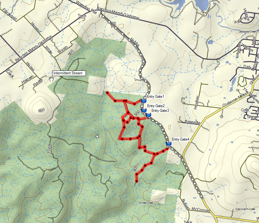
Click Image For Trail Map
No GPX download
These are some roadside trails which run alongside Hobbs Road and down onto the Gisborne - Melton Road. On the latter, stop when you get to the lawn area in front of the farm. This is where the trail ends.
On the Gisborne - Melton Road, the traffic is evident with the noise but on the Hobbs Road part of the trail you'd hardly know the road is there as the trail is slightly set back and the road hidden by vegetation to a degree. The roadside trail is about 7 kms in length so a round trip gives you 14 kms and you can add a circuit within the Lerderderg State Park (red trails to south west of road) to top this up.
Note I haven't ridden the red trails though a post on Rotorburn indicates they are rideable, albeit hilly.The trails are good for a quick training run if you live out west. Trails can be a bit muddy and slippery after rain due to the clay base but nothing too bad.
 |
Parking is available at a number of locations on roadside. |
|---|---|
 |
No toilet facilities are available. |
 |
No drinking water is available. |
 |
No food or drinks are available in the immediate area. |
 |
No local information facilities are available. |